Product
Plot Check
Check your sourcing areas for EUDR, NDPE, and DCF compliance, easily monitor them every month
Upload your plot boundaries, smallholder points, HCS or restoration areas, and more
Save your areas to your private supply chain list shared with your team, so you can easily return and view the results.
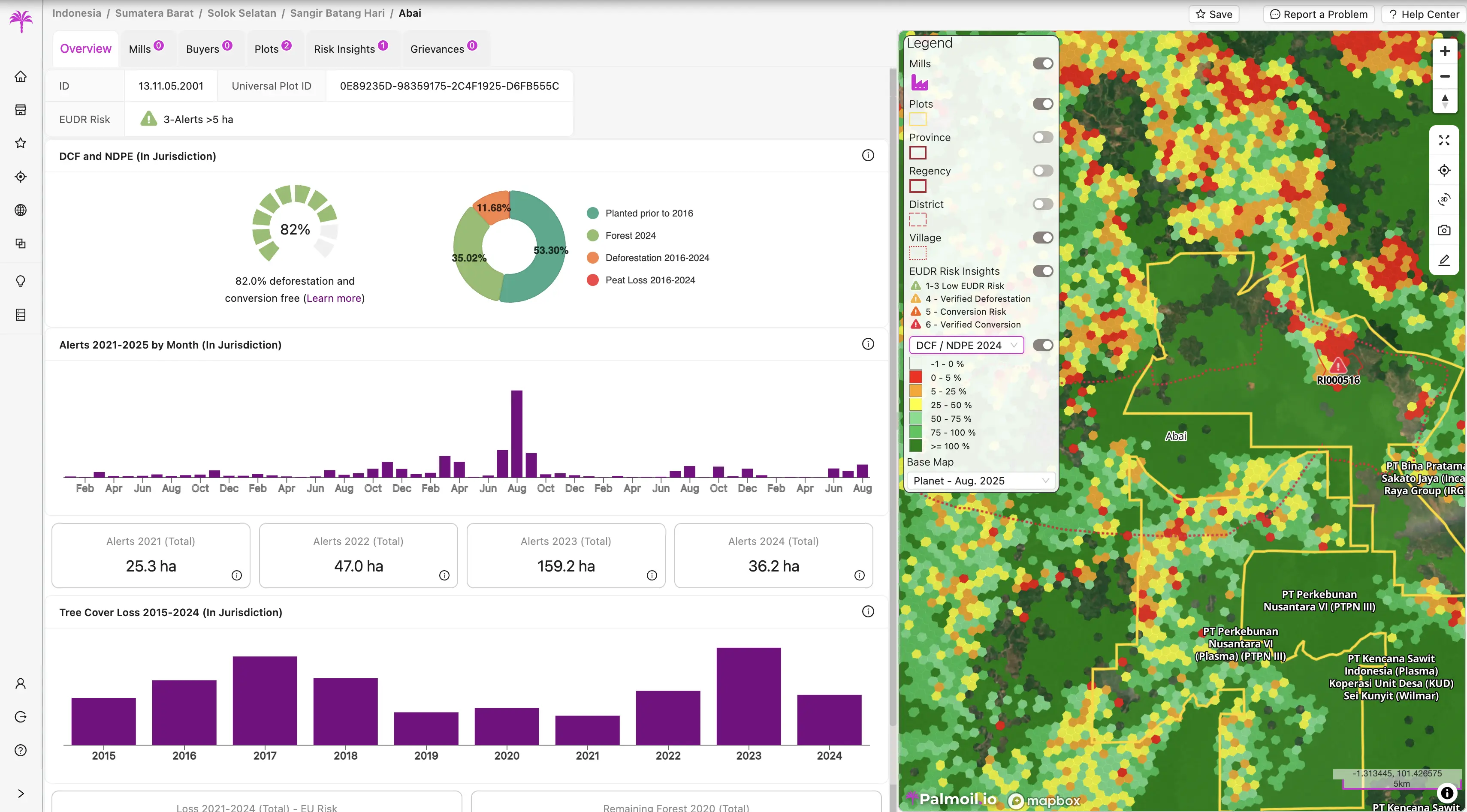
DCF, NDPE, and EUDR reports
Get auto-generated EUDR, NDPE, and DCF reports for your plots
Continuous monitoring
Update the analysis as often as needed, you can always return to a previous result for comparison.
Your private supply chain list
Upload your areas to your private supply chain list
Save your areas to your private supply chain list shared with your team, so you can easily return and view the results.
- Upload boundaries
- Upload and save in your supply chain list Shapefiles, GeoJSON, or KML, with one our more boundaries
- Upload smallholder points
- Upload smallholders points and we automatically generate a buffer radius around the points
- Upload HCS or restoration areas
- Not just for plots, upload HCS areas,restoration areas, and more
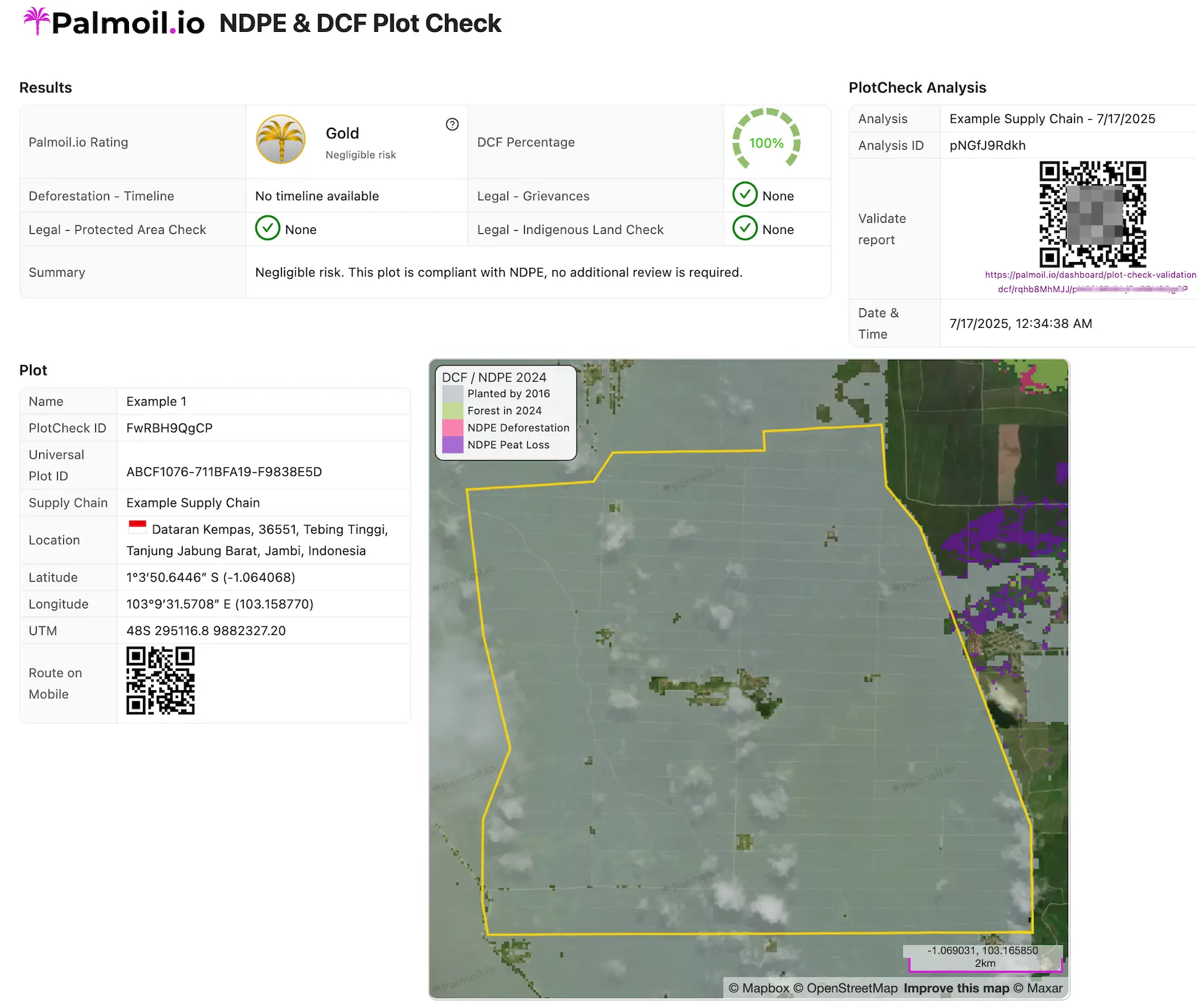
Compliance & Reporting
DCF, NDPE, and EUDR reports
Auto-generate EUDR, NDPE, and DCF reports for your plots
- NDPE and DCF reports
- Get the DCF percentage based on land area, our NDPE gold/silver/bronze ratings, and if there are deforestation or peat loss risks, detailed expert-reviewed reports with satellite imagery, all in one report.
- EUDR reports
- Get a detailed EUDR risk assessment with grievance legality checks, protected area and indigenous land checks, expert-reviewed deforestation reports with conversion confirmation evidence, and more.
- Interactive dashboard and maps
- Not just reports, get an interactive dashboard and maps to visualize your plots on our global supply chain map, risk metrics layers, and monthly satellite imagery.
Monthly monitoring
Continuously monitoring
Update your analysis as often as needed, or every month as we update our database and reports.
- Stay ahead of risks
- Easily know your risks in real-time, while using your private data, no expensive consultants or external audits needed.
- Know your HCS and restoration areas are protected
- Track NDPE and DCF ratings with dynamic plot-level maps and reports to share with customers and suppliers.
- Comply with IRF 6.0 monitoring requirements
- Monitor your directly managed areas (DMA) for land use change (LUC) compliance with IRF 6.0 monitoring requirements.